General Information: Built: Pre-1920s Fully Removed: ~1983 Beginning Point: Mileage 1.10, Laggan Subdivision End Point: Mileage 0.18, BZ Lead General Direction: Southeast
Customers (c.1968) A.B. Cushing Pedlar People Conway's LTD. J.Tynan & Co. Beaver Lumber Bruce Robinson Electric Robert H. Weir Crown Lumber A.C. Weeks Ellison Milling New Building Finance (Barber Ellis) Westburn Industries Enterprise Ogilvie Flour Mills Firestone Tire David L. Jones Standard Surgical Sherwin WIlliams
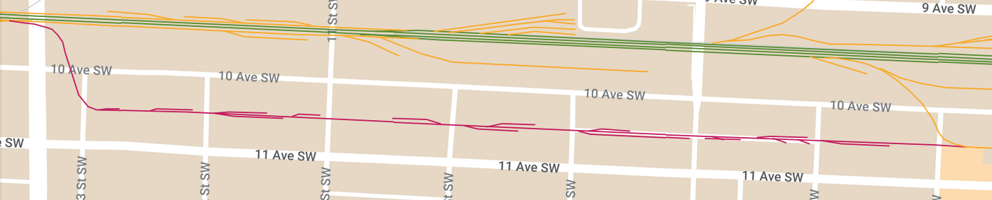
Map See my full map of every rail line to exist in Calgary here! Trackage coloured pink/magenta indicates the BY Lead
More on the BY Lead The BY Lead (along with the BZ Lead) was easily Calgary's most unique spur line. It ran east-west down a back alley in the Beltline, between 10th and 11th Avenue. Whether the alley was paved like it is today or if it was gravel, it's likely that the track was laid in-street and trains would be street running, maybe except for the sidings into buildings. It's quite hard to tell much about the track as the only photos of the track are older, shadowy, aerial images. I don't know of any ground level images of the lead, but boy, what I wouldn't give to see one.
Any remnants of the lead have completely been removed, however, there are two things in the city that hint at the lead being there. The first one is the CP bridge over 14th Street which curves to the southeast on the south side of the bridge. The BY Lead branched off the main line at the bridge and the bridge needed to account for that, and when the lead was removed, the bridge never was altered. You can see how this looks at this link. Notice how the bridge curves - that's where the BY Lead was. The other sign to look for is that certain buildings in the alley where the BY Lead ran have loading docks. Many buildings have been rebuilt and the loading docks removed, but some remain.
The alley in which the BY Lead ran has an abnormal concrete paving in the current day (in most places), which I believe was installed when the rails were pulled up.